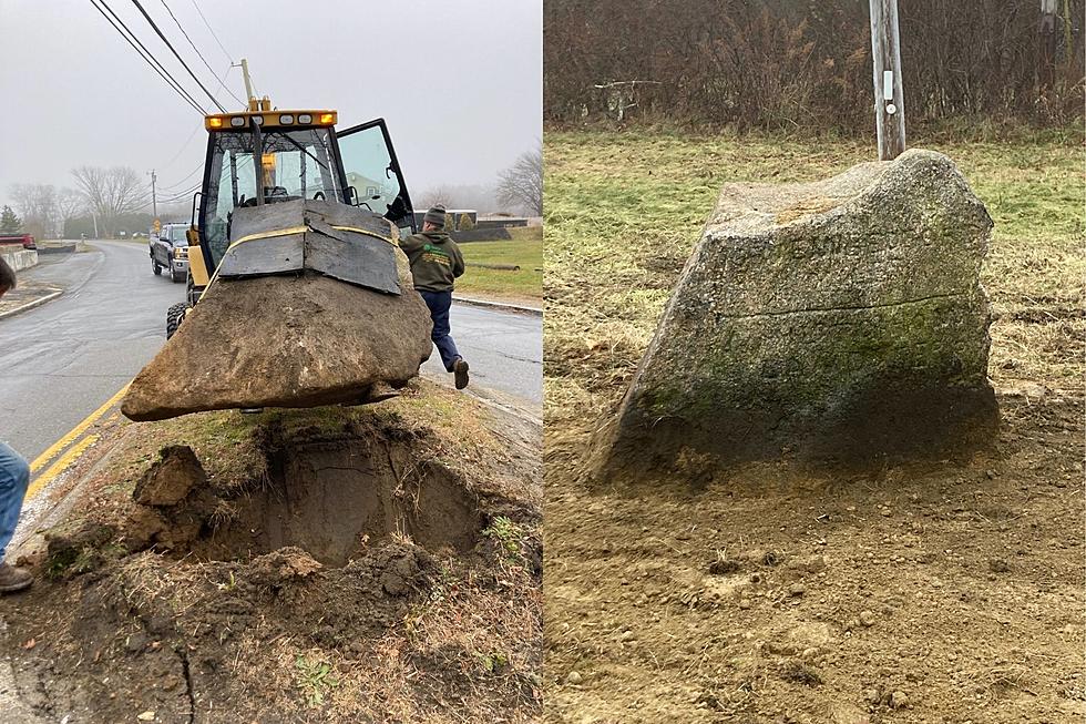
Westport Historic Rock Moved to a Safer and More Convenient Place
There's been a lot of chatter throughout the town of Westport concerning the whereabouts of that old rock on Route 177, at the junction of Sodom Road and American Legion Highway.
Since the 1800s, the rock has played a significant role for travelers navigating the SouthCoast, acting as a mile marker. On one side, it directs you "3-Miles to The Point" and on the other, "11 Miles to New Bedford" and "? Miles to Howland Ferry".
As educational and as sacred this rock may be, it's also caused a headache or two for modern-day commuters. In recent years, truck drivers have run over it, damaging the rock, and others have actually flipped their vehicle. Sure, it might have been an obstacle to anyone who is unfamiliar with the area, but the good news is that there won't, or shouldn't be, any more problems moving forward.
For years, Deputy Police Chief John Bell has been fighting to get the boulder removed and transferred to a better and safer place. It looks as though his hard work payed off, because instead of sitting at the junction of Sodom and 177, the rock now sits proudly by Sodom and Narrows Ave.
In the past, the rock has been defaced and vandalized, but Bell hopes to bring a fresh start to the boulder's new location.
If it helps to preserve local history while also keeping insurance points as low as possible, then it's a win-win situation.

For anyone upset that it's no longer an accurate mile marker reading, it's not like you could read the engraving from your vehicle anyway. In a world full of GPS dependency, technology will reign, but this Westport monument will always be remembered as a tool that paved the way for society's sense of direction.
13 Backroads of Westport, Massachusetts You Must Drive on a Sunny Day
Westport's Version of "Never Have I Ever..."
Post Up at This Breathtaking Beachfront Property For Sale in Westport
More From WFHN-FM/FUN 107


