
SouthCoast “Jackpot Snow Totals and Blizzard Conditions” If Current Storm Track Doesn’t Shift
An important development this morning with the expected weekend snowstorm here on the SouthCoast.
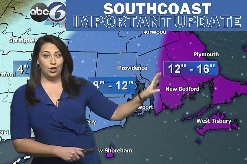
ABC 6 Meteorologist Chelsea Priest reached out to us this morning to let us know about the latest storm tracking that she's seeing. Chelsea wanted to wait until this morning to give us her first snow total predictions. Now that we are less than 48 hours away from the storm, Chelsea is able to get a clearer picture of what is likely to happen, and it looks pretty significant for us here on the SouthCoast.
Jackpot Snow Totals
If the current track of the storm does not shift, Chelsea Priest says the SouthCoast will receive "jackpot snow totals" with 12 to 18 inches or more of snowfall in and around New Bedford and Fall River. "A little shift in the track of the storm would shift where the jackpot totals will land," says Priest.
Damaging Winds and Flooding
However, significant snowfall is only one facet of this storm said Priest. Coastal flooding will be an issue, particularly around high tide. Chelsea also expects strong wind gusts between 45 to 55 MPH to be at potentially damaging levels, which means there is the chance of some widespread power outages, particularly for communities in the eastern part of the SouthCoast and the Cape (where the gustiest of winds will strike).
Storm Prep
Preparation is going to be important for this one said Chelsea. Making sure snowblowers are starting up and gassed up along with available generators. She encouraged SouthCoast residents to make their preparations today and tomorrow while the weather will be cold, but sunny and dry.
The winter storm watch will be in effect from 1am on Saturdaay until midnight on Sunday.
More From WFHN-FM/FUN 107


